Achievements
ICAR-Indian Agricultural Research Institute
Mapping Biophysical Products of crop field using Drone Remote Sensing and Big Data Analytics
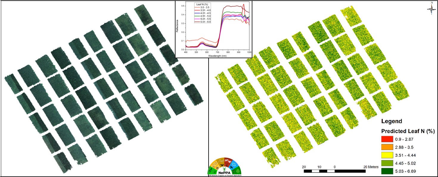
A hybrid approach of radiative transfer modeling combined with a machine learning (ML) algorithm is proposed for the retrieval of the leaf area index (LAI) and canopy chlorophyll content (CCC) of wheat cropland. A hyperspectral image captured from a UAV platform with a spatial resolution of 4 cm and 269 spectral bands ranging from 400 to 1000 nm was processed for the retrieval of the LAI and CCC of wheat cropland. The radiative transfer model PROSAIL was used for simulating spectral data, and eight machine learning algorithms were evaluated for hybrid model development. The ML Gaussian process regression (GPR) algorithm was selected for the retrieval of crop traits due to its superior accuracy and lower associated uncertainty. LAI and CCC biophysical maps were validated against in situ measurements, yielding R2 values of 0.889 and 0.656, suggesting high retrieval accuracy.

Drone based Nitrogen stress monitoring of Field Crop
Timely assessment of plant N at a spatio-temporal scale enables its precision management in the field scale with better N use efficiency. The present study attempted to assess plant N in a wheat field using a UAV hyperspectral imager with a spectral range of 400 to 1000 nm. A total of 61 vegetative indices were evaluated to find suitable indices for estimating plant N. A hybrid method of R Square (R2) and Variable Importance Projection (VIP) followed by Variance Inflation Factor was used to limit the best suitable N-sensitive 13 spectral indices. The selected indices were used as feature vectors in the Artificial Neural Network algorithm to model and generate a spatial map of plant N in the experimental wheat field. The model resulted in R2 values of 0.97, 0.84, and 0.86 for training, validation, and testing respectively for plant N assessment.
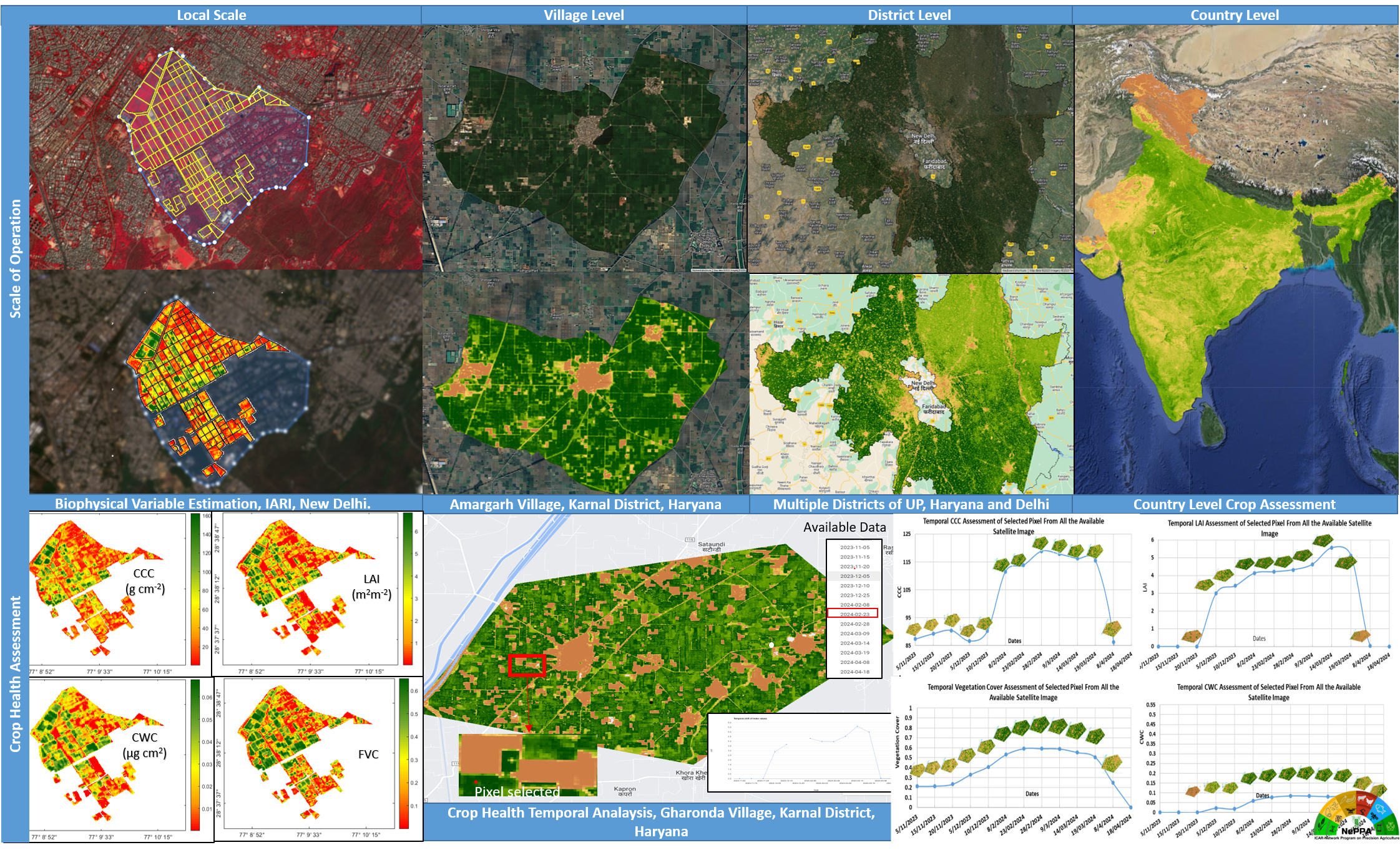
Near Real-time monitoring of crop fields through Satellite Remote Sensing
Google Earth Engine (GEE) has reduced the limitations of traditional remote sensing with respect to extensive data analysis of Big Data. The platform allows access to several open and commercial satellite datasets at various levels of processing stages. These datasets could be visualized, processed, and used to assess the condition of the crops across large spatial and temporal scales. An effort was made to construct and integrate a model that could analyze the Sentinel – 2 surface reflectance dataset and estimate the Leaf Area Index of crops across various landforms using the GEE.
Real Time Soil Fertility Assessment in Lab Conditions
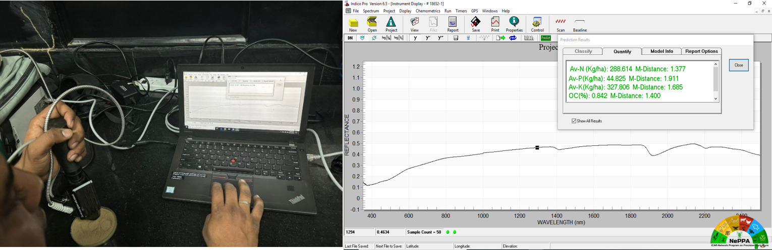
Soil fertility assessment is critical when trying to understand the soil’s potential to support crop growth, food security, and the economic growth of the farmer. Conventional wet chemistry methods provide the best accuracy when studying soil fertility, but they cannot deliver results in real-time wasting precious resources and time. Thus, an innovative approach was developed where the live spectro-radiometer spectra of the soil sample feeds into a machine-learning model that accurately assesses the Nitrogen, Phosphorus, Potassium, and Soil Organic Carbon available in the soil in real-time.
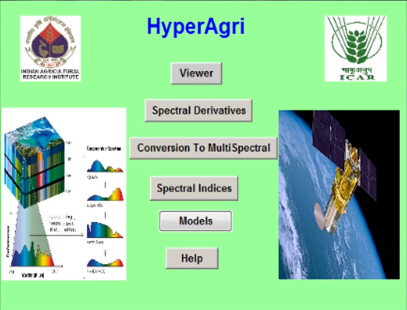
HyperAgri : In-House Software for Drone Data Analysis
In-house software developed for processing hyperspectral data captured on ground and drone platforms. It facilitates the calculation of spectral derivatives and spectral indices. We can compute over 120 hyperspectral indices in different aspects like nitrogen, chlorophyll, etc. It allows the resampling of hyperspectral data to multispectral.
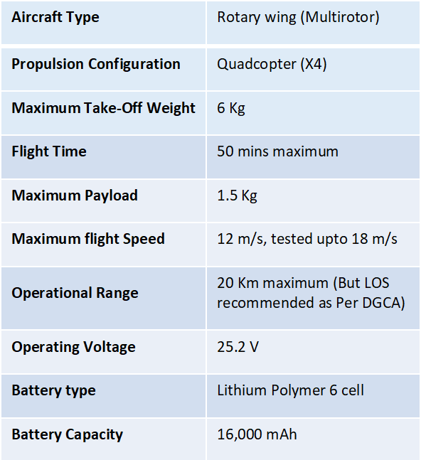
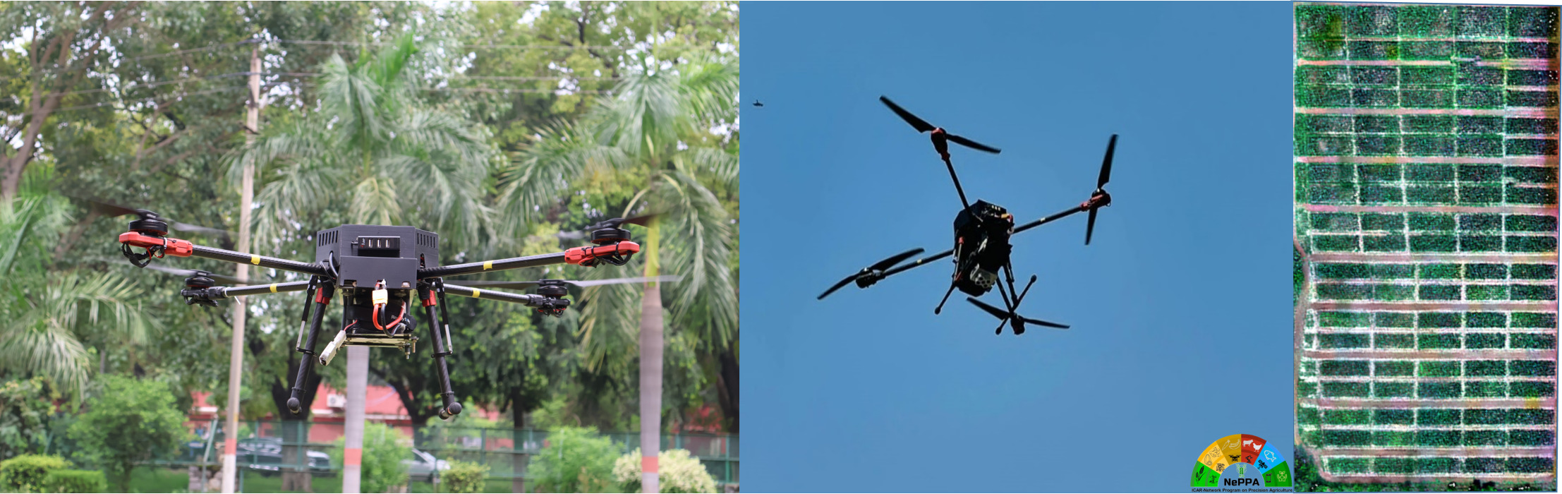
Inhouse – Imaging Drone for Research and Development
An Indigenous drone is developed in Drone and Big Data Analytics lab of IARI under ICAR – Network Programme on Precision Agriculture. The drone has a payload capacity of 1.5 Kg and can fly for maximum 50 minutes. The main purpose of developing this drone is to have a stable and reliable aerial platform, which can remain airborne for longer duration and also can carry remote sensing payloads for crop health monitoring.
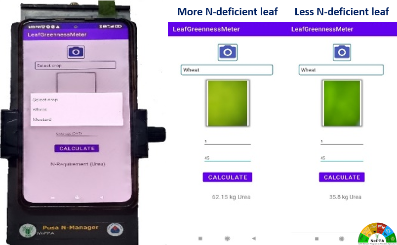
Pusa N Manager: smartphone-based precision nitrogen management
The Pusa Nitrogen Manager is a smartphone-based device to quantify the requirement of nitrogen fertilizer at a particular growth stage of wheat crop. This device determines the optimal N fertilizer requirement by integrating RGB images and crop simulation models (CSM). The device is having its own light source (not influenced by ambient light condition), contact sensing (not affected by image focus) and using CSM at backend (semi-empirical in nature).
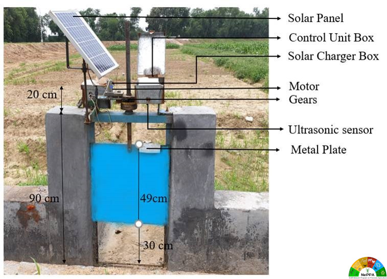
Soil Moisture Sensor-Based Automatic Basin Irrigation System
The automatic irrigation system consists of three main units: a sensing unit, a communication unit, and a control unit. The sensing unit is comprised of a capacitance-based soil moisture sensor, PVC pipe, solar panel, microcontroller, and LoRa module. Communication unit comprised of LoRa module and a GSM module. The control unit is comprised of solar powered check gate with a control unit. Wireless communication between soil moisture sensors and check gate was established via LoRa and GSM module. Two minimum soil moisture sensors should be placed in the basin for a unit area. One for the opening of the check gate and one for closing the check gate. The findings suggested that one sensor should be placed in the middle of a field (50% field length from the inlet) at 15 cm depth for the opening of the check gate and another should be placed at 25% field length from the inlet and 37.5 cm depth if soil moisture depletion ≥ 40% otherwise placed at 75% field length from inlet and at 7.5 cm depth if soil moisture depletion ≥ 20%. The system was evaluated in the research field of IARI in wheat crop. A total of 25% of water was saved through real-time soil moisture status-based automatic irrigation systems than the conventional manually controlled system under wheat crop
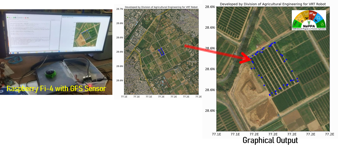
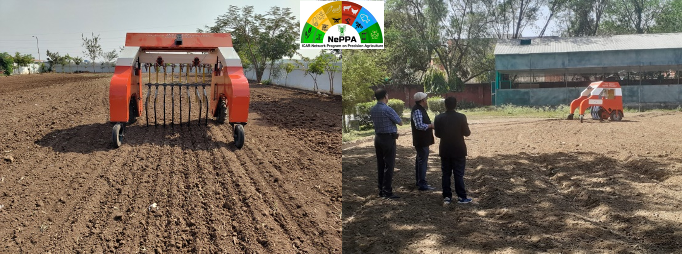
Variable rate fertilizer applicator (VRFA): VRT Robot for Fertilizer Application
A Variable Rate Technology (VRT) based robot for fertilizer application has been developed under NePPA project. The robot is useful for applying the fertilizers in tall crops as it is having ground clearance of 1.6 m. The robot can store about 60 kg of fertilizer in the fertilizer hopper. The fertilizer application rate can be controlled as per the input data. GPS based Grid data (latitude, longitude, fertilizer type, application rate) can be uploaded to the robot controller for applying the fertilizer automatically. The robot gets the signal from the rotary encoders fitted with the ground wheel for estimating the forward speed. The fertilizer metering unit works in synchronization with forward speed of the robot.
The robot is having the swath width of 1.83 m. The track width, wheel base, height and weight of the robot are 2.42m, 2.65m, 2.10m and 950 kg respectively. The robot can be controlled with the help of remote control and the working range is about 1 km. Specially designed eight number of furrow opener can work up the depth of 15 cm. A hitch bar is provided for connecting with the tractor and to take it far distances.
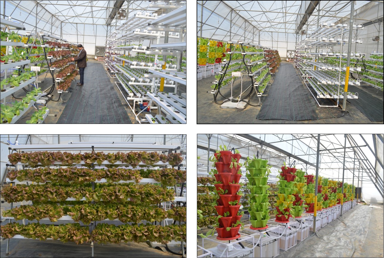
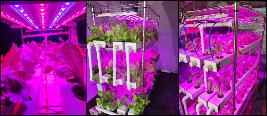
IoT and Sensor Operated Greenhouse for Vertical Farming
Climate Controlled Greenhouse (1000 sq meter) with Vertical Farming Models Designed, Installed and Evaluated for different Leafy Vegetables (Lettuce, Basil, Pok Choi, Spinach and Mint)
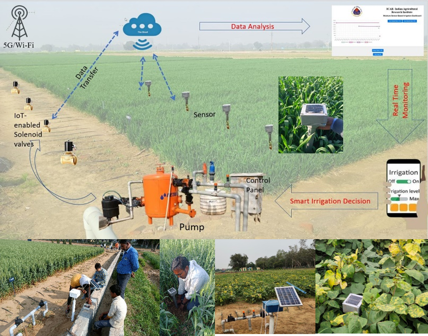
IoT based Sub-surface Drip Irrigation Automation in Cereal based Cropping System
Water Resource conservation is promoted through smart management, minimizing water and energy-efficient systems contribute to reduced overall resource consumption. Drip Irrigation system is an efficient method for water and nutrient savings which needs automation. Automatic sub-surface drip irrigation system consists of drip system where dripper installed at 20 cm depth, fertigation system, electric water pump, soil moisture sensor (SMS), solenoid valve enabled with solar panel and cloud server with a simple smartphone interface for soil moisture monitoring and irrigation scheduling which has been installed in IARI field. Solar powered capacitive soil moisture sensors based irrigation scheduling is performed in effective crop root zone using Internet of things (IoT) in cereal based cropping system to revolutionize traditional irrigation practices by optimizing water resource utilization, maximizing crop yields, improving crop quality and enabling precision agriculture, enhancing environmental sustainability, facilitating remote management, and promoting overall innovation in Irrigation Management. Due to the sub-surface drip system water application efficiency achieved > 95%, water saving 30-40%, nutrient saving 40-50%, crop yield increased by 25% and B:C ratio: 1.85-2.1.
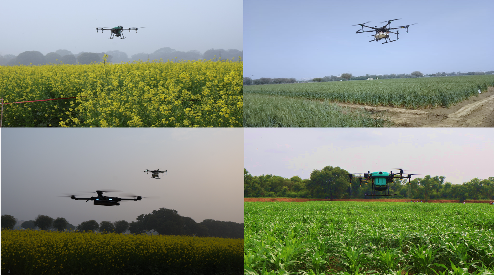
Drone-based site-specific input management system
A drone-based site-specific input management system refers to using drones equipped with technology to precisely apply inputs such as pesticides, fertilizers, or other substances to specific areas of agricultural fields. The concept of site-specific input management involves applying inputs only where they are needed, based on real-time data and analysis of the site. The systems integrate data from various sources such as satellite imagery, sensors on the ground, and historical data to create maps and plans for the drones to follow. They use algorithms to optimize where and how much input is applied, maximizing efficiency and minimizing environmental impact. The system development is under process.
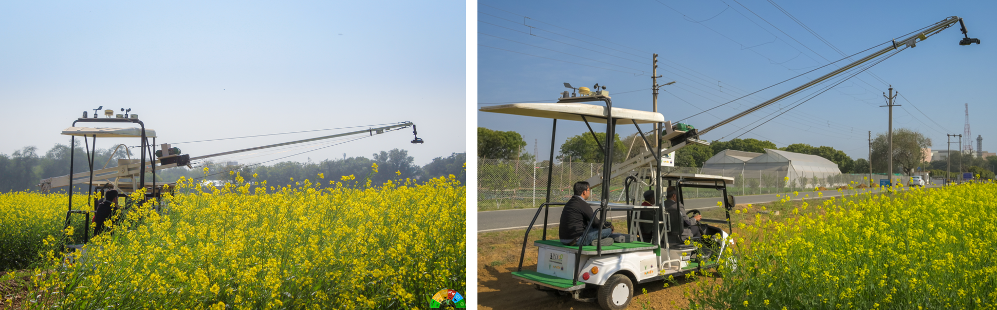
Real-time crop surveillance using field robot: Phenomobile
The traditional method of monitoring crop health using imaging and non-imaging remote sensing sensors has limitations regarding the area that can be covered in a labor-intensive environment. The Phenomobile is a GPS-guided autonomous, stable, mobile platform that resulted from a necessity to overcome these limitations. The Phenomobile was built on a robust mobile platform that has the ability to navigate through difficult paths usually found around agriculture fields with ease. The vehicle features a self-stabilizing boom that can be adjusted for various heights and angles of observation required for monitoring the desired crop. Thus, the platform provides an extremely stable stage for capturing highly accurate data of the crop from various remote sensing sensors mounted on the boom. Typically, the then mobile hosts a spectro-radiometer along with multispectral and hyperspectral imaging sensors for studying multiple traits of the crops.
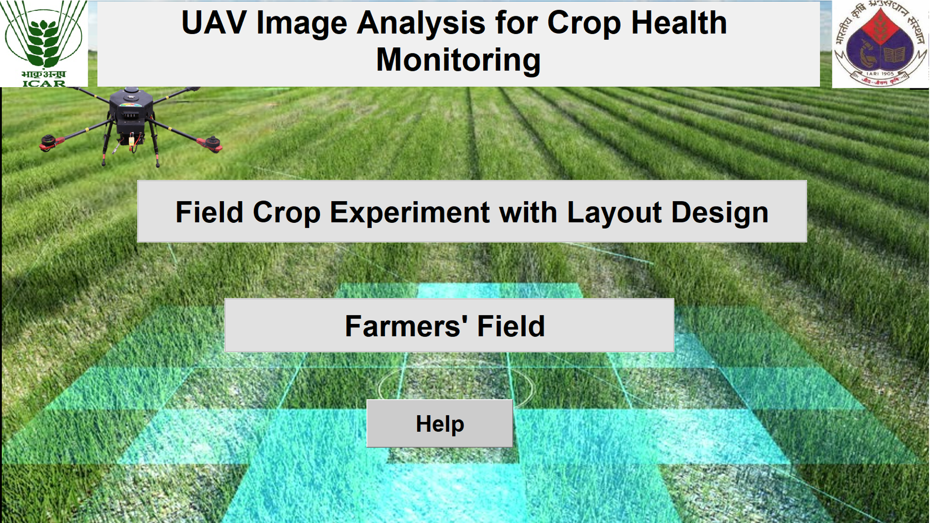
DroneAgri: In-House Software for Drone data processing
DroneAgri was built in-house to streamline the pre-processing of the images captured from UAV-mounted sensors like RGB and multispectral sensors, keeping the research community’s and farmers’ requirements in view. The unique feature of the package is that it allows the user to specify the accurate number and size of each plot and subplot in an experimental field, removing the need for complex pre-processing steps. The setup provides access to several vegetation indices, which can be calculated as a batch process for the selected plots. The same methods could also be used for farmers’ fields, where the entire field can be selected as a single plot.